In our recent (and ongoing) poll of particle physics researchers, almost 70% of you said that you like experiencing the great outdoors during your free time. Lucky for you: the candidate site for the ILC, the Kitakami mountains, lies in the Tohoku region, a pristine and pastoral area of Japan. That means you’ll never run out of forests, mountains, beaches, and grassy meadows to explore. One of the most intriguing places to visit is a long trail spanning the Pacific Coast. The Michinoku Coastal Trail (MCT) stretches over 900km, covering the coast of Tohoku from Aomori Prefecture to Fukushima Prefecture – and Iwate Prefecture lies right there in between.
Tell me about the Michinoku Coastal Trail
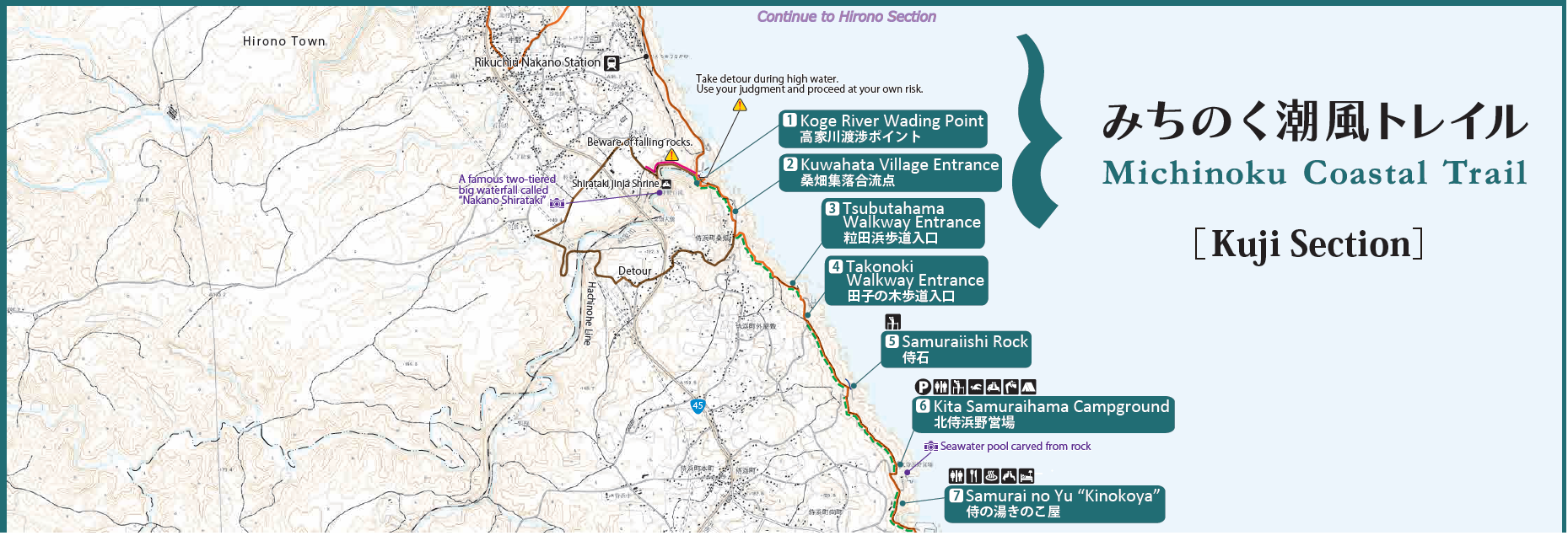
The area where we visited on this trip (Map taken with permission from the Ministry of Environment’s website for the Michinoku Coastal Trail)
There are long trails across the world, like the Appalachian Trail in the United States and the Greater Patagonian Trail along the border of Chile and Argentina, but the MCT is rare in the sheer variety of experiences it offers, thanks to how it follows the ocean for around 900 kilometers. You can enjoy the ocean view as you climb up and down sandy cliffs and verdant mountain paths. Spend a few kilometers walking down a deserted beach and wind through hand-carved caves. Walk along a road weathered by the ocean spray, which will take you by a small fishing village where you can enjoy the hospitality of the local villagers (and some tasty fresh-caught fish!).
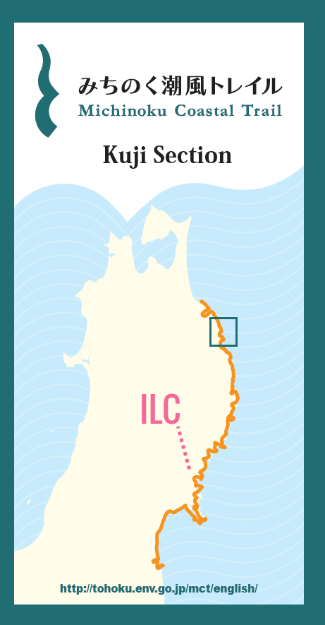
A map of the entire MCT with the Kuji Section Map highlighted (Map taken with permission from the Ministry of Environment’s website for the Michinoku Coastal Trail)
This trail offers a unique insight into people’s everyday lives: their relationship with the sea, its bounties and its dangers. Traveling by car or train, you don’t get a chance to stop and chat with people drying seaweed or pass by people’s gardens. The MCT is full of experiences you can’t get elsewhere in Japan, or the rest of the world for that matter, and the ILC candidate site only lies about 20-30 km from the nearest portion of the trail!
According to the MCT’s PR official, Ms. Masami Itabashi, the trail should be complete by the end of March 2019, and work is underway to add multilingual signage to the whole trail and translate a full set of English maps. You can enjoy a 1 day hike, or a 3-4 day odyssey (or heck, even longer! There’s a guy who walked the entire trail). The trail winds by stations and through towns, so you also have the opportunity to buy goods and meals from villages that are still recovering from the 2011 earthquake and tsunami, aiding in their reconstruction.
The Kitakami Times Tour of the MCT
-

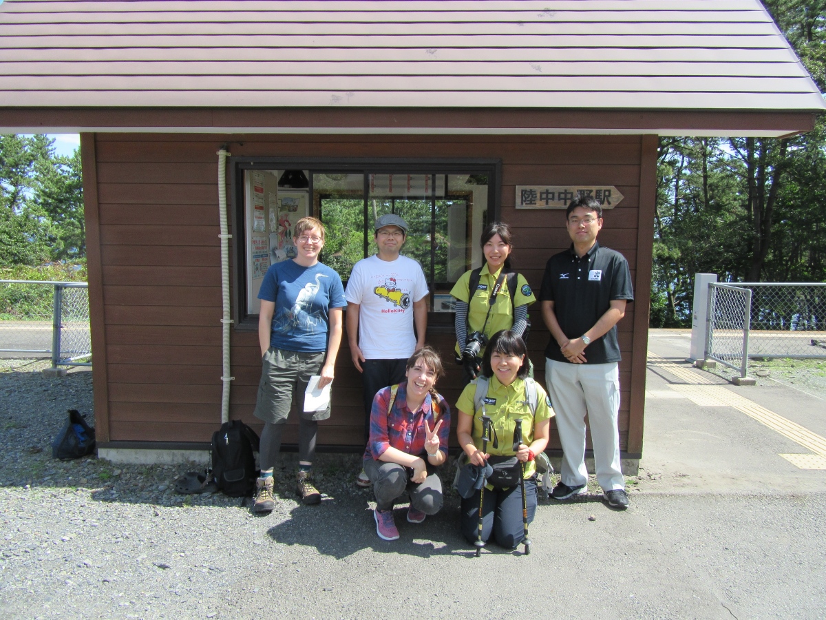
- Our group of adventurers outside of Rikuchu-Nakano Station
-
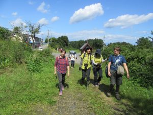
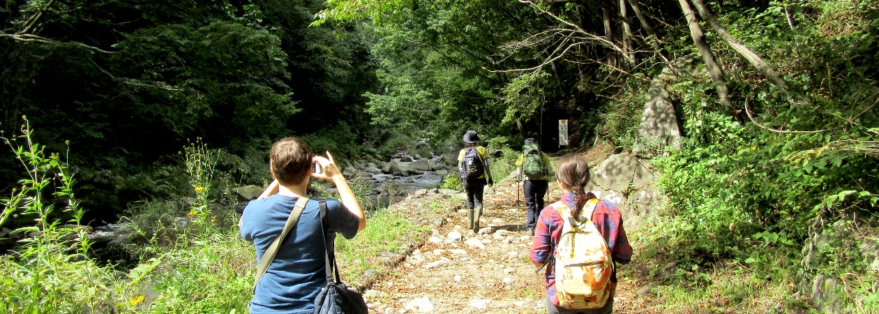
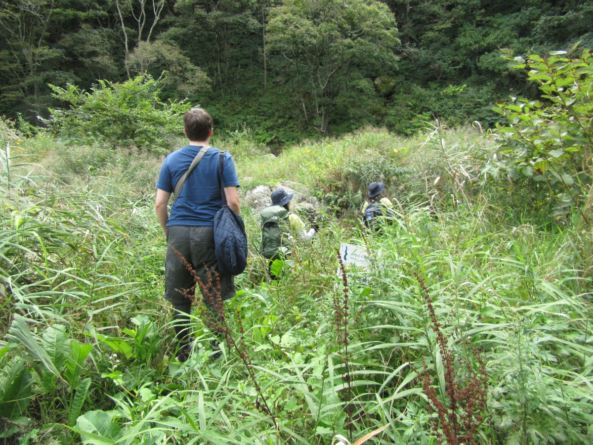
- Setting off down the path

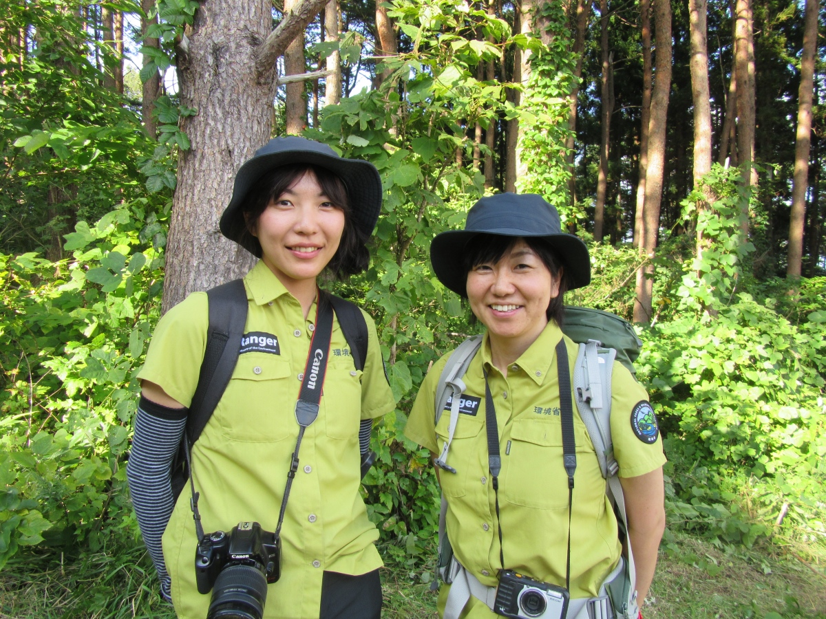
From the Ministry of the Environment, Active Ranger Ms. Yuriko Furudate (left) and PR Staff Ms. Masami Itabashi (right)
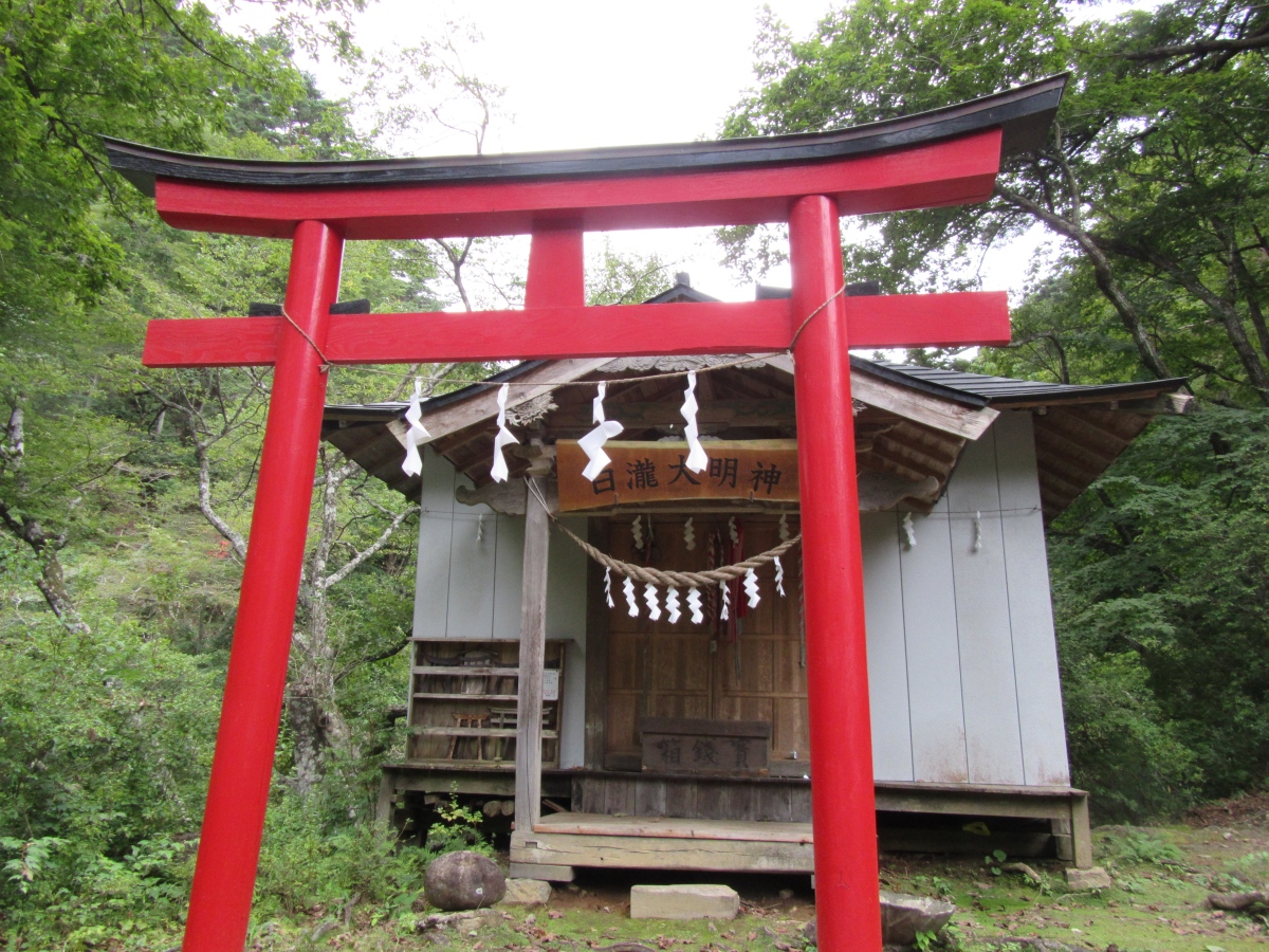
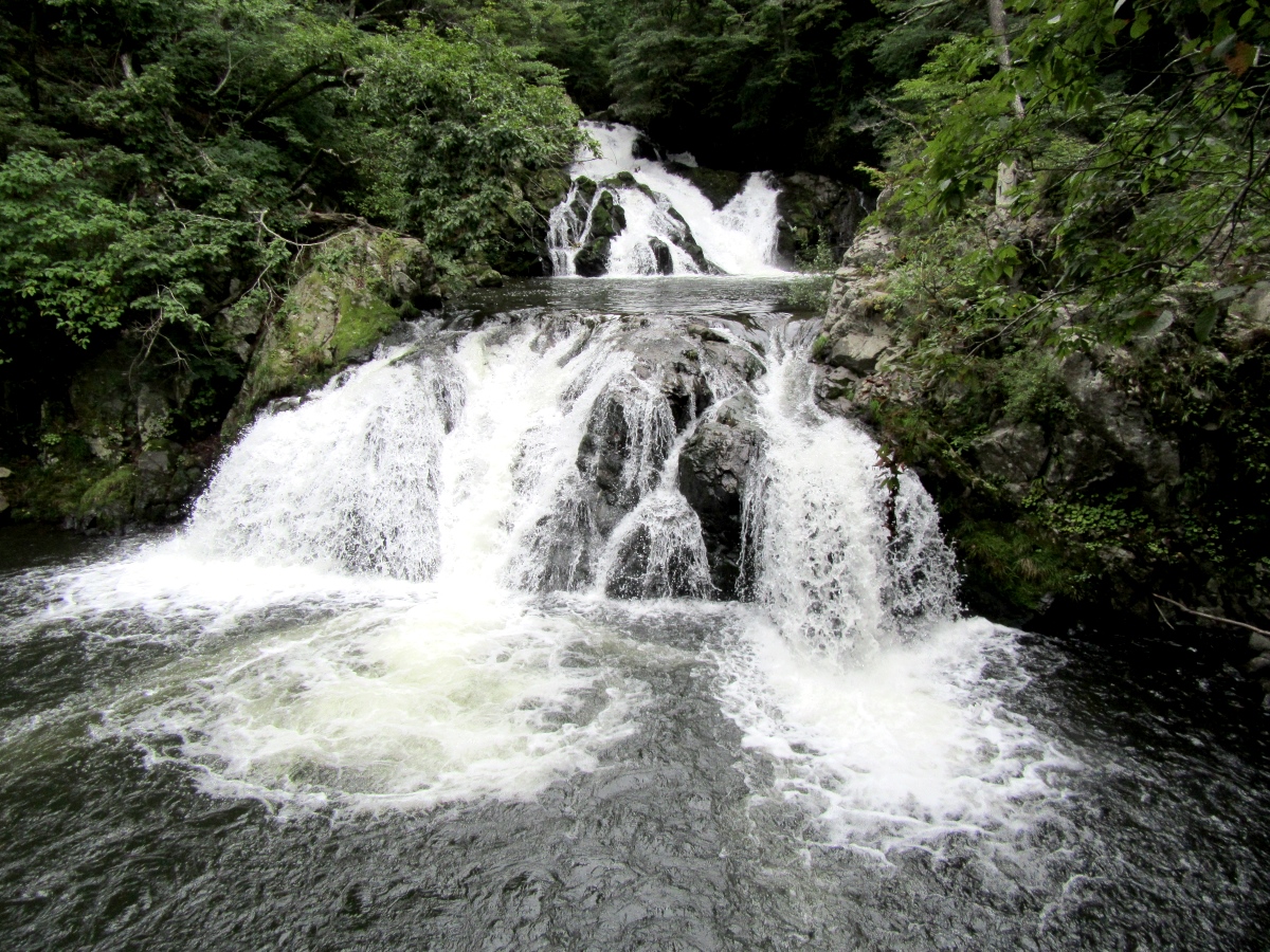
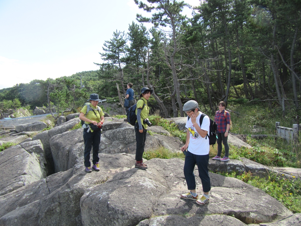
On a warm day in mid-September, THE KITAKAMI TIMES authors traveled to northern Iwate with two officials from the Ministry of Environment to take in the trail. We drove from Morioka, which took about 2 and a half hours (public transportation is also available, albeit a long journey), and stopped at rest stops along the way to peruse local goods. We arrived at Rikuchu-Nakano Station at about 11 am, where there was a MCT sign in both Japanese and English to greet us. Active Ranger Ms. Furudate (yes, it’s a real job!) led us down a small path towards the ocean, which winded around to bring us to a waterfall and shrine.
-
- Walking down the road
-

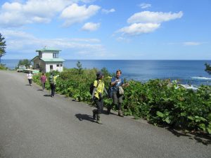
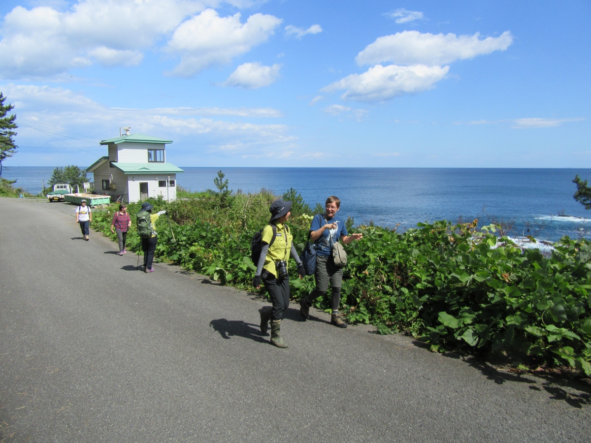
- The view from the mountain road
-

- A shrine by the side of the path
-
- Nakano Shirataki Falls
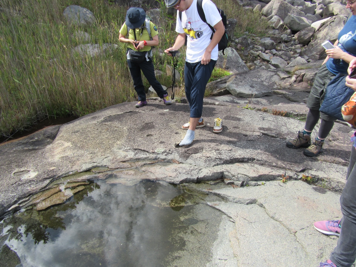
There’s a place on the trail where you can cross a river to the other side, but unfortunately the water level was too high due to recent rains (there is a secondary path you can use to go around). Remember to bring boots (or at least Crocs/flip-flops) if you don’t want to get your shoes wet!
-

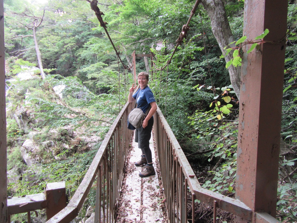
- Anna on a narrow little bridge by the waterfall
-

- Anna, Active Ranger Ms. Furudate, and Ms. Itabashi inspect the river crossing point. Due to the rain from the previous week, it was a bit too high for us to cross this time!
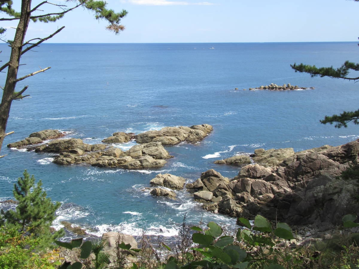
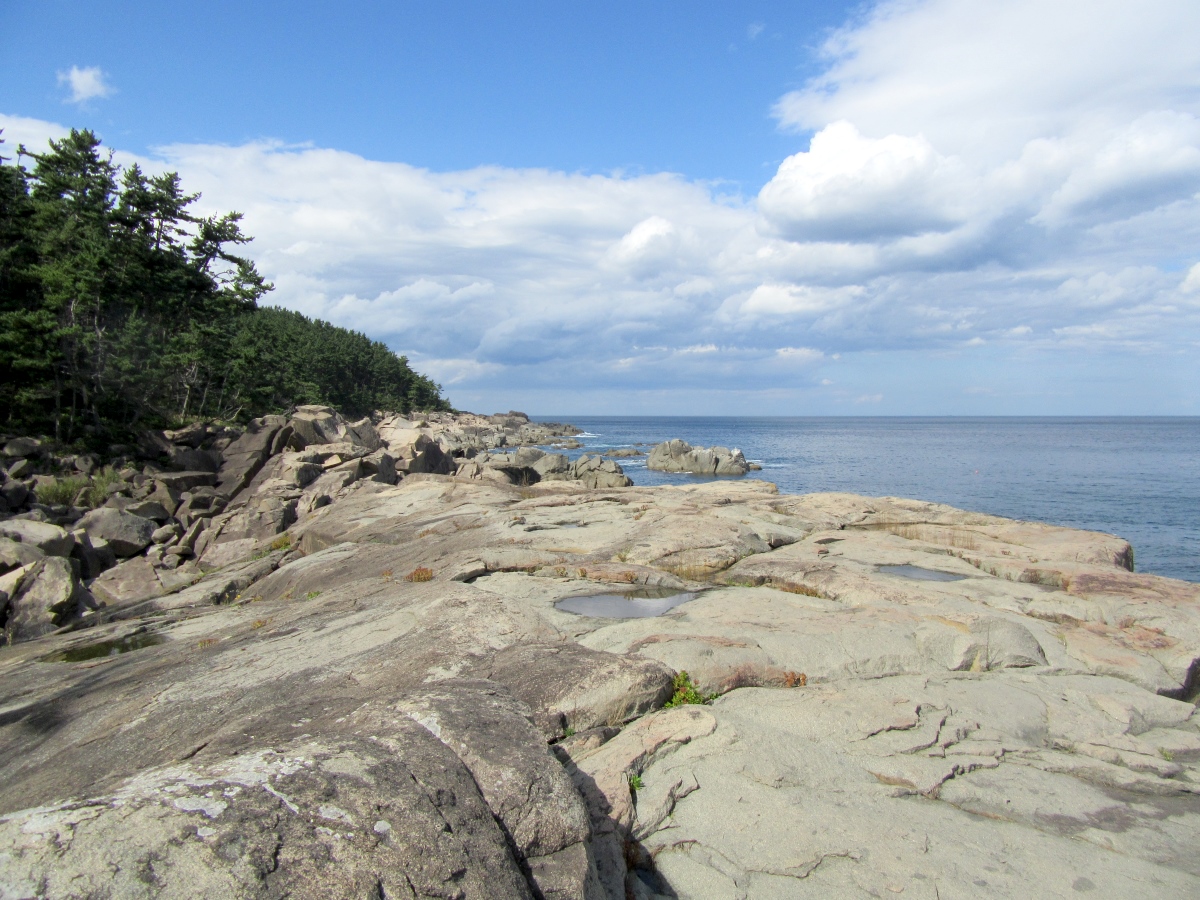
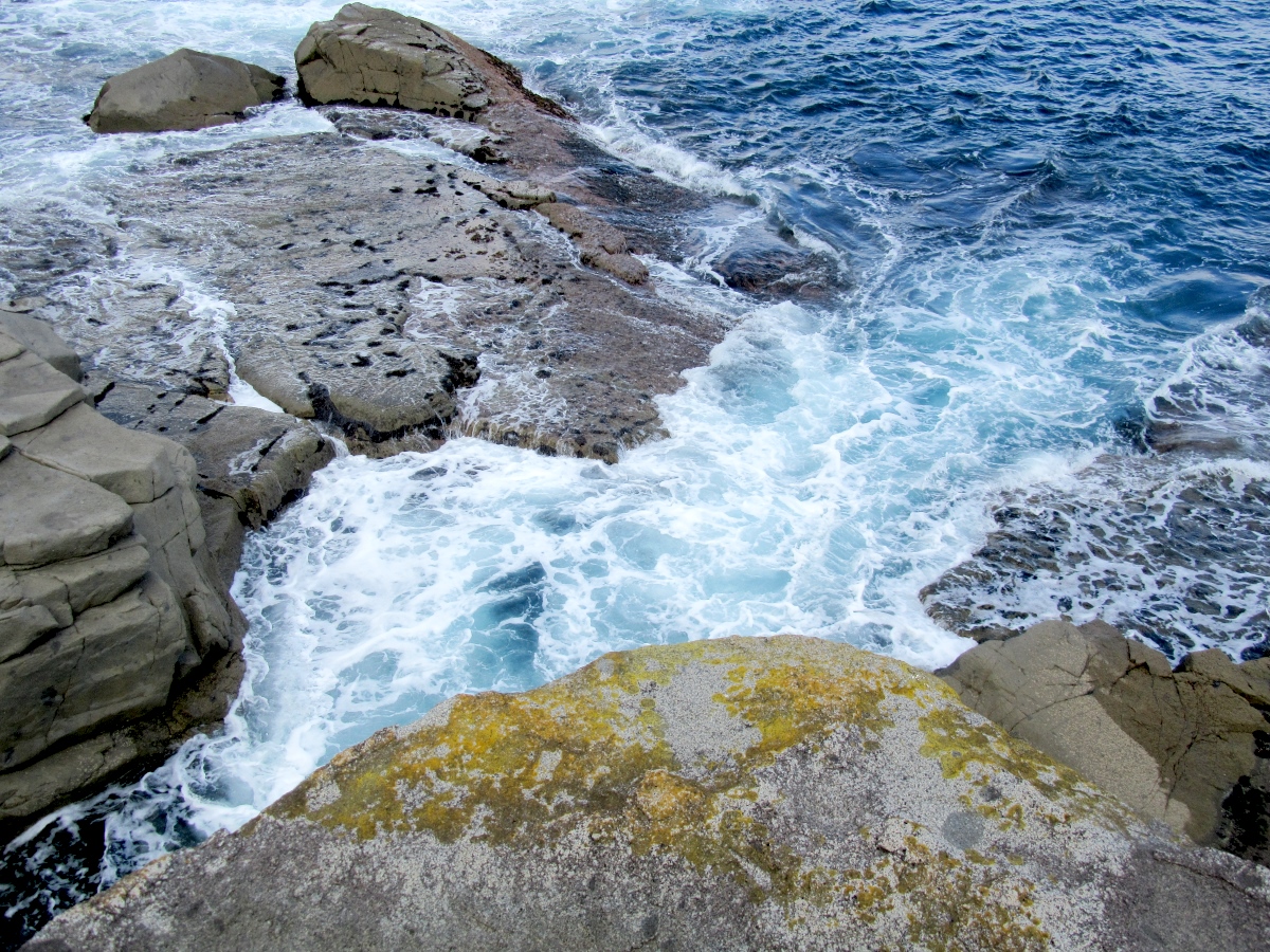
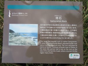
Later that day, we arrived at a place called Samuraiishi Rock. Literally “Samurai Rock”, this huge geological rock outcropping was formed over millions of years as the ocean weathered the granite smooth. The ocean waves crashed and swirled around the rocks, and fishing boats could be seen far out in the ocean. This is definitely a place to see even if you aren’t hiking the trail. Ms. Furudate commented, “I like it when the trail all of a sudden comes out from the forest to a wide expanse where you can see the ocean.”
-

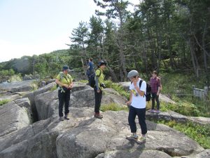
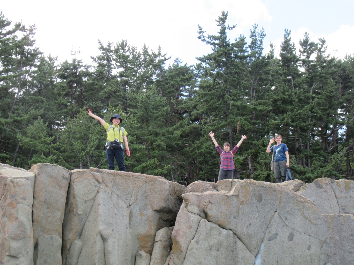
- Samuraiishi Rock
-
- The cover for our new album: THE KTIMES ~Waiting on a decision
So who’s the samurai? A samurai lord was said to have taken a rest here in 1614 when he was touring the area to inspect damage following a tragic tsunami. There’s even a small hole that looks like it could perhaps be his footprint. Ms. Furudate continues, “The MCT is a trail where you can see both the beautiful scenery and vegetation of the coast, as well as the culture and history intrinsic to each region it passes through.”
-

- The waves at Samuraiishi Rock
-
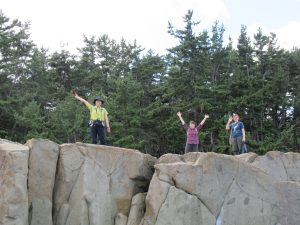
- Hello from Samuraiishi!
-
- An example of bilingual signage on the trail
-

- Mr. Oikawa of Ichinoseki tries to see if his foot is samurai-sized
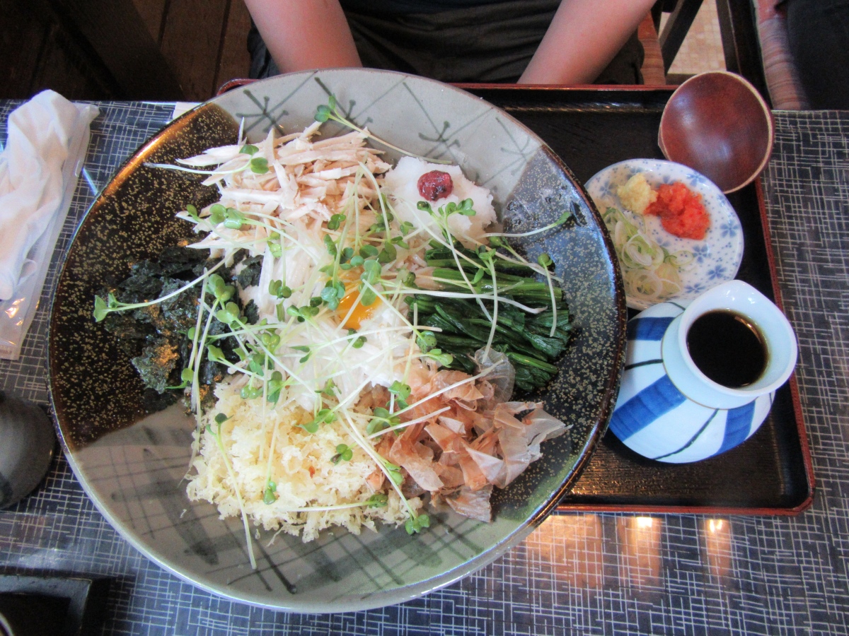
After taking some pictures, we headed towards a lunch in town at a small noodle shop. I say small, but they had every type of soba and udon you’d like. There was also a humongous rice ball available, which I guess you might need after a tiring day at the trail. We headed home by car after that, but you could keep going down the coast to the Kita Samuraihama campgrounds for the night, or even to a nearby hot springs facility if you’d like to enjoy a hot soak and a good meal. Conversely, you could also head north to Aomori, and eventually reach the Northern Terminus of the trail at Kabushima. Most of the trail is open in Kamaishi and Ofunato on the southern coast of Iwate as well.
-

- Soba noodles topped with mountain vegetables and more
-
- A humongous rice ball (we should have placed a hand nearby for size comparison)

Ms. Itabashi recommends routes that take you through small fishing ports and villages. “After walking for hours through untouched nature, it’s nice to come up to a place where you see people living their lives. I get so happy that I end up chatting up the local people, and I hope that other hikers interact with the locals as well. Even if there’s a language barrier, I’m sure you’ll both end up smiling. I think this is something you can only really experience on the MCT.”
The MCT is truly a beautiful way to experience the nature of the coast of Iwate and the rest of Tohoku, and will be a great respite for researchers who will come from all over the world for the ILC. Let Iwate’s natural beauty heal your soul, and see something hidden from the outside world at the MCT. Ms. Itabashi said it best about her hopes for a new audience through the ILC: “The trail could be a way for you to learn more about the Tohoku region and the many facets within. I hope you’ll come to the trail over and over again, as each time you should discover something new.”
In the future
They’re planning on building a Trail Center (name TBD) in Natori City of Miyagi Prefecture sometime in the next fiscal year, which would oversee the operations and maintenance of the entire trail. Sendai Airport is also located in Natori, and it’s also only about 2 hours from Tokyo, so it will be a good place to give information to foreign hikers and do promotional activities.
In the mood for some hiking?
If you’d like the try the trail yourself, you can check out the Ministry of Environment’s English page. While there are English/Japanese signs along the trail, there are some spots where it might be easy to get lost, so Ms. Itabashi says you must take along a map. They have some portions of the trail maps available online in English, which you can print out full-size or use with the full-size physical maps in Japanese. They also plan to produce physical English maps in the future.
http://tohoku.env.go.jp/mct/english/
There’s also their Facebook page, which is usually in Japanese, but you can view some pretty pictures.
https://www.facebook.com/michinoku.trail/
View the Explore Tohoku page, where the author walked the entire trail and posted his experiences along the way
https://www.facebook.com/exploretohoku/
Our very own Anna Thomas has a site with some extra English language information on the trail
http://michinoku-shiokaze.blogspot.jp/
See a video taken last year of the MCT by the Kitayamazaki cliffs in Tanohata (northern Iwate coast). Incidentally, this is one of Ms. Itabashi’s favorite spots: “It’s hard to choose, but I do like the routes like this where you can hear waves crashing on gravel beaches. It’s just really nice to walk the trail while hearing the rhythm of the waves gurgling up on little round stones.”
https://www.facebook.com/pref.iwate.pr/videos/1864916633741637/
One last note for future hikers from Active Ranger Furudate: “Even if it’s hot outside, you should wear long pants, or leggings with shorts or a skirt. Any exposed skin could be at risk to mosquito bites or could brush by some inflammatory urushi weeds.”
Japanese
絶景を誇るみちのく潮風トレイル東北の海岸線を歩きながら自然のパワーを感じる約900キロのロングトレイル
和山アマンダ
この間、岩手県が実施した「ILC建設候補地周辺の住環境に関するアンケート」では、趣味についてアウトドアや自然が好きと答えた回答者がおおよそ70%を占めました。そのような方々へ良いお知らせがあります!ILC建設候補地である北上山地は、自然豊かな田園地帯として知られている東北地方にあります。東北には森・山・海・草原など、自然のワンダーランドが盛り沢山。そこで、東北の太平洋海岸線沿いに「みちのく潮風トレイル」というロングトレイルが設定されています。全ての地域の総距離が900kmを超えるトレイルであり、岩手県を含め、青森県から福島県までまたがります。
【みちのく潮風トレイルについて】
地図:今回取材したエリア のトレイル(環境省みちのく潮風トレイル公式ウェブサイトよりマップの一部抜粋)
世界中に、米国のアパラチアントレイルやチリ・アルゼンチンの境を超えるパタゴニア地方のトレイル など、いくつかロングトレイルがありますが、みちのく潮風トレイルは900km以上も海岸線を通ることから、実にバラエティに富むトレイルになっています。海の絶景を見ながら、山道 を歩き、人影のない砂浜まで下りて手掘りの洞窟を通り、海風に風化されてきた道路を通って漁師の集落に出て、地元の人と楽しく交流するなど、楽しむ方法が沢山あります。(しかも、新鮮な魚も食べられます!)
地図:トレイルの全体図(久慈市マップ/英:Kuji Section Map)((環境省みちのく潮風トレイル公式ウェブサイトよりマップの一部抜粋)
更にいうと、みちのく潮風トレイルは、豊かな恵みとともに、時として脅威をもたらす海を「故郷」と呼ぶ人々との交流や、海辺での日常を感じられる機会を提供しています。家の庭で昆布などを干している地元の人へ声を掛けるなど、車や電車ではできないでしょう。そのように、日常から離れたMCTならではの体験が沢山あります。そして、そんなMCTの最寄りの入り口は、ILC建設候補地から20~30キロしか離れていないため、研究者のレジャースポットになる可能性が高いです。
トレイルの広報担当によると、環境省では来年度末までの全線開通を目指しており、現在日本語版・英語版の標識の整備や英語の公式マップの作成を進めています。日帰りのレジャーから、全線開通後はスルーハイクをするなど トレイルの楽しみ方は人それぞれです。また、トレイルは駅や街中も通るので、2011年3月の東日本大震災津波からの復興に取り組んでいる沿岸市町村で買い物や食事をすれば、復興支援にもつながります。
【THE KITAKAMI TIMESのみちのく潮風トレイルのツアー】
(写真のキャプション)
左上:K-TIMES取材団が陸中中野駅の前
右上: いざ出発!
下: 環境者から、アクティブ・レンジャー古館百合子さん(左)と広報担当の板橋真美さん(右)
9月半ばの暖かい日に、THE KITAKAMI TIMESの取材団はトレイルを歩くため、環境省の職員2人と一緒に岩手県沿岸北部へ行きました。盛岡から運転して、約2時間半かかりました(公共交通手段もありますが、少し長めの旅となります)。ところどころのレストエリアで停まって地域の特産物など買い物をしました。午前11時頃、陸中中野駅に到着した時、トレイルの公式な日本語版・英語版の標識に歓迎されているような気がしました。アクティブ・レンジャー古館さんの案内により、海を望める道へ向かって出発し、中野白滝とその付近の神社へ向かいました。
(写真のキャプション)
左上: 道をゆっくり歩く
右上: 山道から見える風景
左下: 道の脇の神社
右下: 中野白滝
道の途中、向こう側へ川を渡るところがありましたが、今回は前の週に降った雨により、水位が高く渡らないことにしました。(川が渡れない時のために、迂回路も設定されています。)ここで靴を濡らしたくない人には、長靴を持参することをお勧めします。
(写真のキャプション)
左: 中野白滝付近、アンナさんが狭い橋を渡る
右: アンナさん、アクティブ・レンジャー古館さん、板橋さんが川の渡る地点をチェックしている。前の週に降った大雨のために今回はちょっと水位が高かった。
その後、車で「侍石」というところに移動しました。ここで海から露出した岩体は、何億年も波に風化されたすべすべした花崗岩です。波が岩に打ち寄せており、海の遠くに小さな漁船が見えて、トレイルに限らず、美しい風景が見られるスポットの1つです。「(ここのように)森の中を抜けた先に広がる海の景色が好きです。」と古館さんがトレイルの見どころを紹介しました。
(写真のキャプション)
左: 侍石
右: アルバムカバーのようなグループショット
ところで、侍石の「侍」には、実はこんな言い伝えがあります。江戸時代初期(1614年)の南部藩主が津波被害を受けた三陸沿岸を見舞った際、この岩の上で休憩を取ったことから侍の石と云われるようになりました。しかも、侍の足跡と思われる靴の形のくぼみもあります。「トレイルは、沿岸の自然豊かな風景や動植物、地域ごとに培われてきた文化や歴史を感じられる道です」と古館さんがさらに説明しました。
(写真のキャプション)
左上: 侍石に打ち寄せる波
右上:侍石の上 からハロー!
左下: 日本語版・英語版標記
右下:一関市の及川さんが自分の足が侍サイズかどうかを確認
写真を撮った後、街に向かい小さなそば・うどん屋さんで昼食を取りました。「小さい」と言いましたが、実はそばやうどんの様々な種類を提供している店でした。また、一日トレイルで疲れたハイカーにはぴったりな大きいおにぎりもありました。その後私たちは帰りましたが、もし侍石からそのままトレイルを歩き続けるのであれば、南へ向かって北侍浜野営場、あるいは温泉施設に泊まることができます。温泉なら、ゆっくりと風呂に入って美味しいごはんを食べるという方法もあります。または、北へ向かうと青森県に入り、トレイル北の玄関口(英:Northern Terminus)である蕪島にたどり着きます。そして、もちろん岩手県沿岸南部の釜石や大船渡のトレイルも開通していますので、楽しみ方が沢山あります。
(写真のキャプション)
左:山菜などが乗ったそば
右:あの大きなおにぎり
板橋さんからおすすめの場所があります。「小さな漁港や集落を通るルートがおすすめです。自然の中を長時間歩き続けた後に人々の暮らしが感じられる場所に出ると、つい嬉しくなって地元の人を見つけると声を掛けてしまいます。皆さんもぜひ地元の人たちと交流してみてください。うまく言葉が通じなくてもきっと笑顔で通じ合えるはずです。これこそみちのく潮風トレイルならではの体験だと思います。」
みちのく潮風トレイルは、岩手や東北の豊かな自然を楽しめるルートであり、世界中のILC研究者がアウトドアを楽しめるレジャースポットになると期待されています。トレイルでは、岩手県の自然に癒され、まだよく知られていない魅力を発見することができます。「東北にお越しになる研究者の皆さんには、トレイルをきっかけに東北の中にも様々な地域があるということを知っていただきたい。何度もトレイルを歩いてもっと深くその魅力を発見していただければ幸いです。」と、板橋さんがILCの研究者にも期待を寄せています。
将来に向けて
板橋さんによれば、環境省は来年度、宮城県の名取市にみちのく潮風トレイル全線の管理・運営を統括する施設「トレイルセンター(仮称)」を建設する予定です。名取市は仙台空港が立地し、また東京からも約2時間と近いため、トレイルセンターは海外からのハイカーへの情報提供やPRを行います。
あなたもハイキングに来ませんか?
トレイルを体験したい方は、ぜひ環境省運営の英語ホームページをご覧ください。板橋さんによると、道に迷いやすい場所があるため、公式マップは必須です。ホームページには、一部のマップが英語に訳されているため、日本語の公式マップと合わせて活用してください。公式マップは現在は日本語版のみの発行となっていますが、将来的には英語版も作成する予定ですので、楽しみにしていてください。
http://tohoku.env.go.jp/mct/english/
みちのく潮風トレイルのFacebookページ
https://www.facebook.com/michinoku.trail/
Explore TohokuというFacebookページ(著者はトレイルのすべてを歩き、そこで経験したことをアップしています)
https://www.facebook.com/exploretohoku/
KTIMESのアンナ・トマスさんが書いている英語ブログでは、さらなる情報が書いています。
http://michinoku-shiokaze.blogspot.jp/
昨年、岩手県の外国出身の職員勉強会「国際アイデアの会」において、田野畑村の北山崎周辺のトレイルを取材し、動画を制作しましたのでご紹介します。
ちなみに、ここは板橋さんの好きなところの一つです。「私が好きな場所は、礫浜に打ち寄せる波の音が聞こえるルートです。丸い小石がジャラジャラと転がる波のリズムを聴きながらトレイルを歩くのはとても心地が良いです。」
https://www.facebook.com/pref.iwate.pr/videos/1864916633741637/
アクティブ・レンジャー古館さんからの注意:「天気が暑くても、長ズボン又はハーフパンツにレギンスを履くなどの対策をしましょう。肌を出した服装の場合、蚊に刺されたり、漆や草に肌が負けて、肌が荒れる場合があります。」