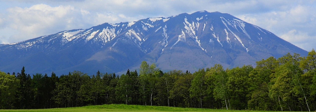
Mount Iwate is one of the most famous mountains in all of Iwate, and has long been beloved as a symbol of the Shinto religion. Hikers and mountaineers fill the mountain paths even today. With a height of 2,038 meters, Mt. Iwate is the tallest mountain in the entire prefecture. The mountain has many different “looks” depending on which side you’re standing on, but looks a lot like Mt. Fuji when you’re looking at it from Morioka City. That is why it’s sometimes called “Nanbu Fuji” or “Mt. Fuji of the North.”
There are seven trails up the mountain, each with its own characteristics. You could pick one to climb up and a different one to climb down to enjoy a number of unique mountain climbs. At the top, you’ll be treated to a far-reaching view of the entire northern Tohoku area, but there’s also a Shinto shrine and statues you can explore at the top, calling back to the mountain’s history as a Shinto religious spot.
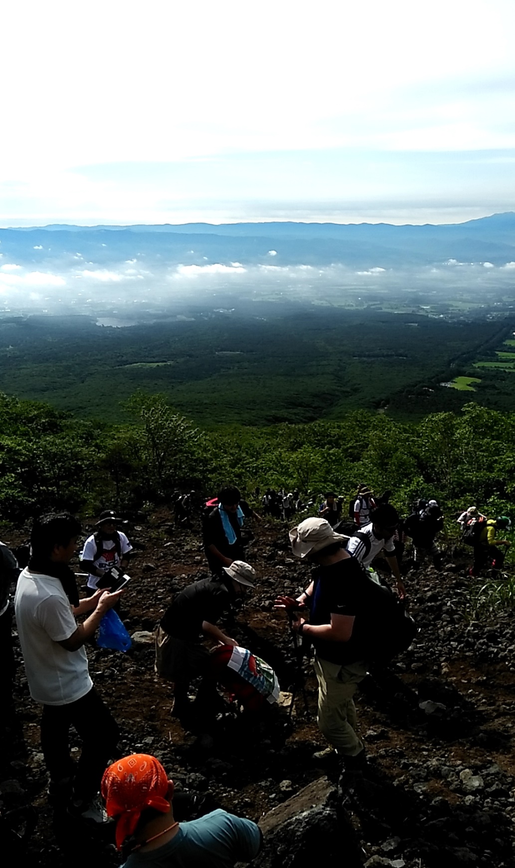
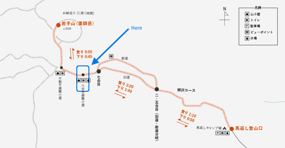
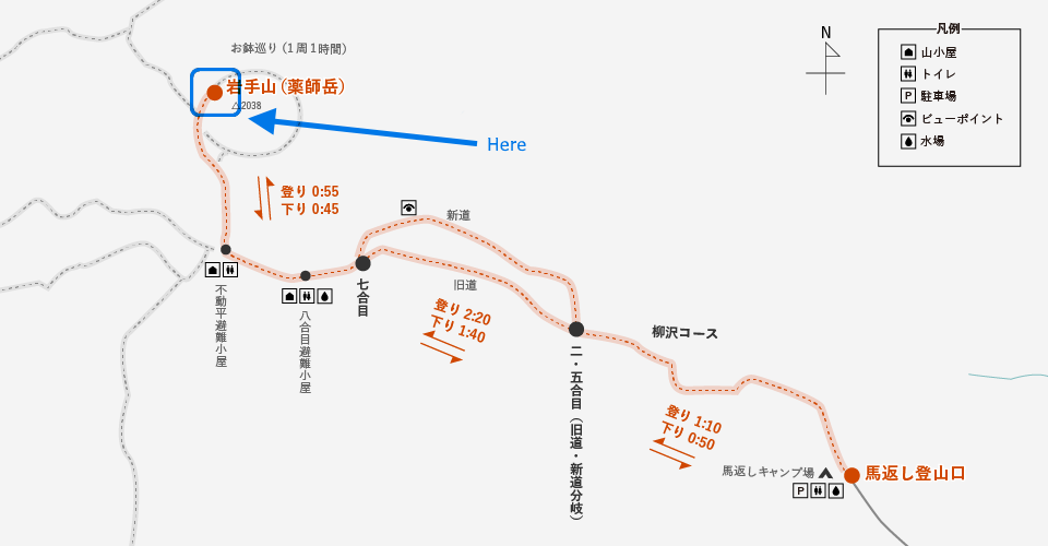
(the blue circle shows the trail we took)
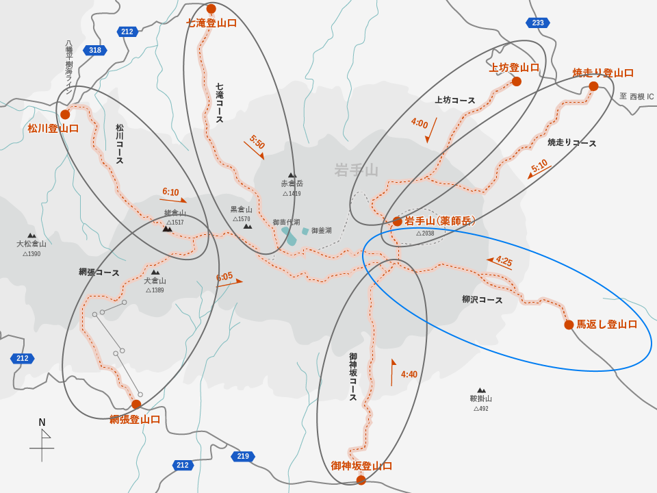
Map: From the Towada-Hachimantai National Park homepage (Ministry of Environment)
URL: https://www.env.go.jp/park/towada/hachimantai/course/course_007/index.html
Usually during our ILC Relay articles, we show off Iwate residents who are involved with the ILC, but this time we felt it was high time to show you the high mountain – Mount Iwate! More specifically, we wanted to show you Mount Iwate on July 1st, the day when the trail opens to the public each summer.
On July 1st, a bunch of staff from the ILC office of the Iwate Prefectural Government climbed the mountain together. We started from the Umagaeshi trailhead, which is the start of the Yanagisawa course. Being the first day open of the year, the trail was packed with other climbers.
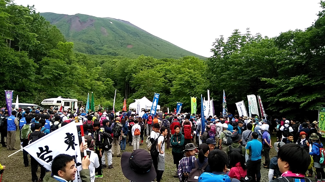
The Umagaeshi trailhead, packed with climbers (6 am).
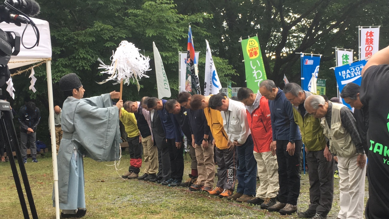
Right before everyone set off, there was a Shinto prayer rite to pray for a safe climb.
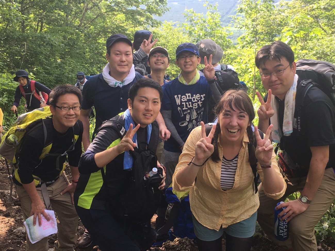
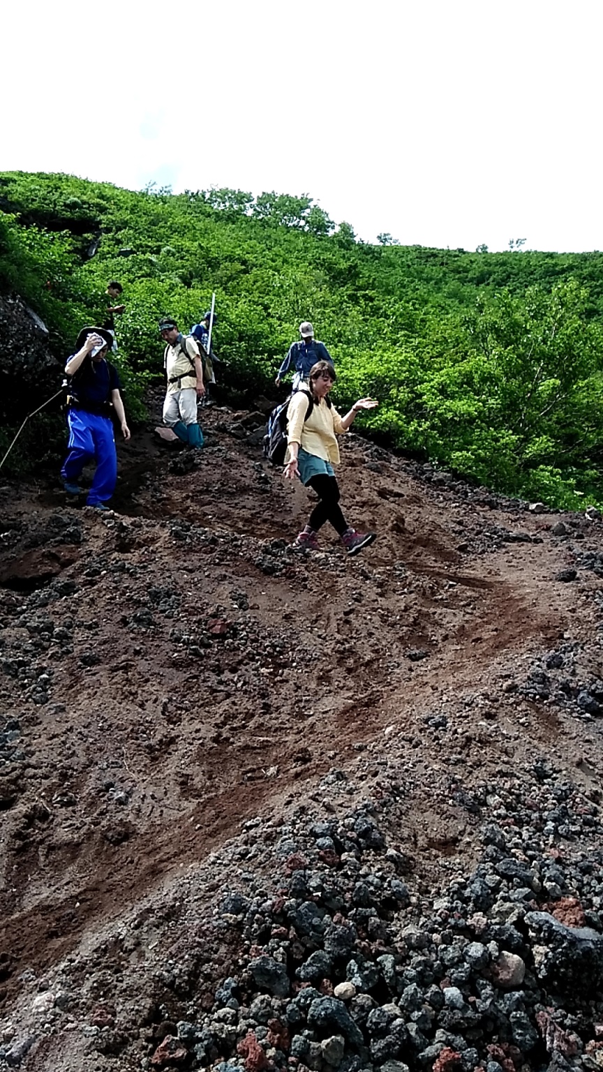
Our team! We were really gung-ho at first… lol.
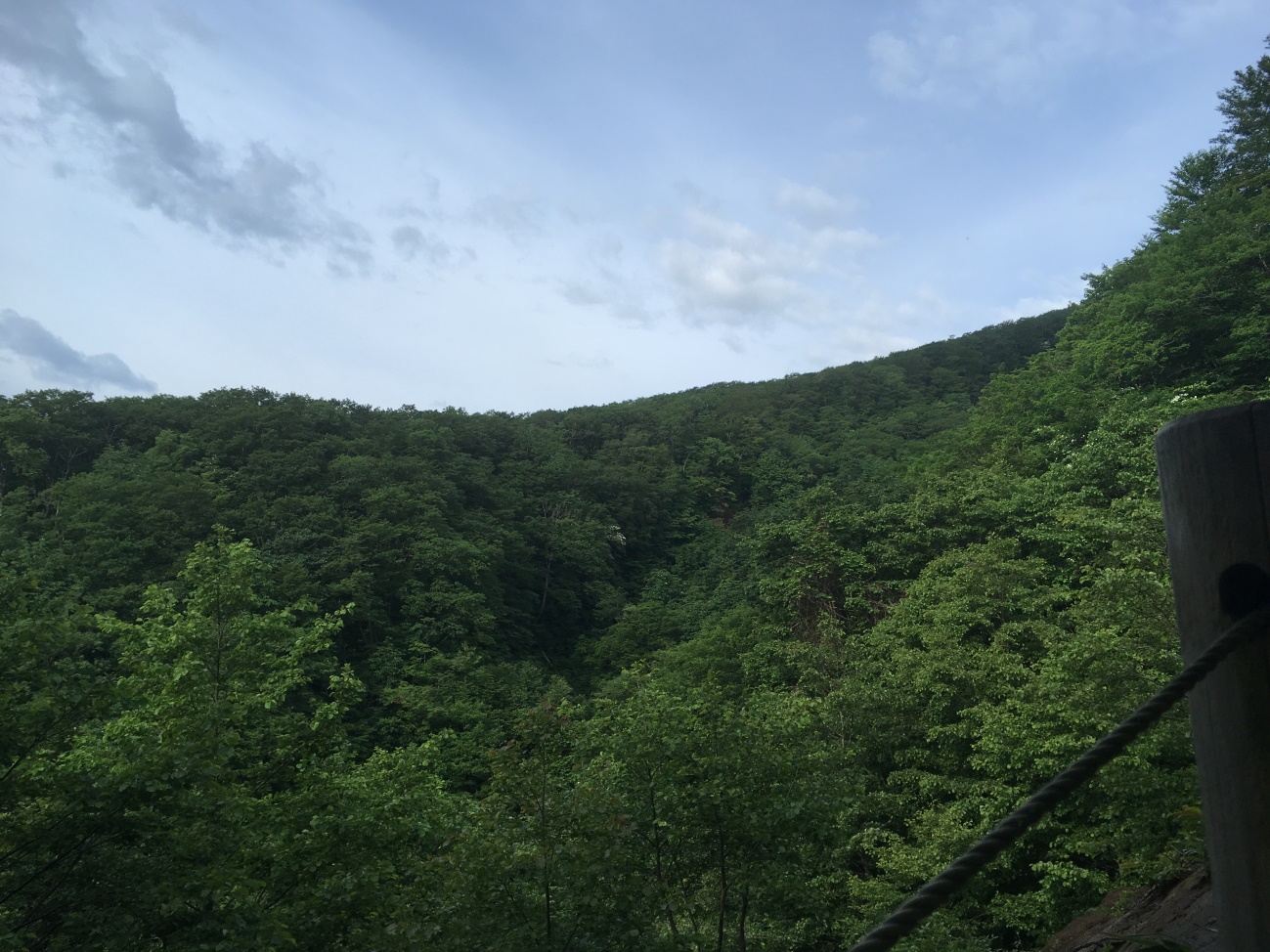
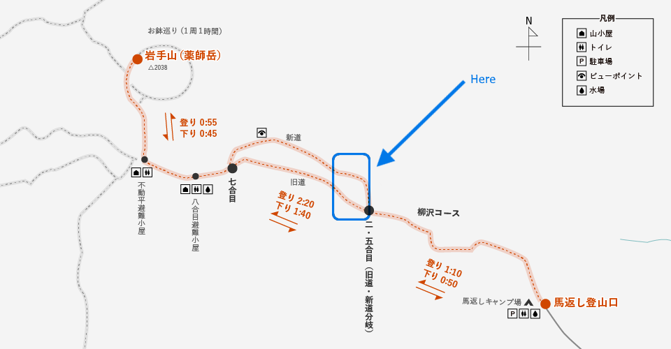
The trail was surrounded by a beautiful backdrop of trees.

When we looked out into the distance, we could see we were surrounded by some serious nature.
Map: From the Towada-Hachimantai National Park homepage (Ministry of Environment)
URL: https://www.env.go.jp/park/towada/hachimantai/course/course_007/page_01/index.html
Then we looked behind to behold an awesome view.
Map: From the Towada-Hachimantai National Park homepage (Ministry of Environment)
URL: https://www.env.go.jp/park/towada/hachimantai/course/course_007/page_01/index.html
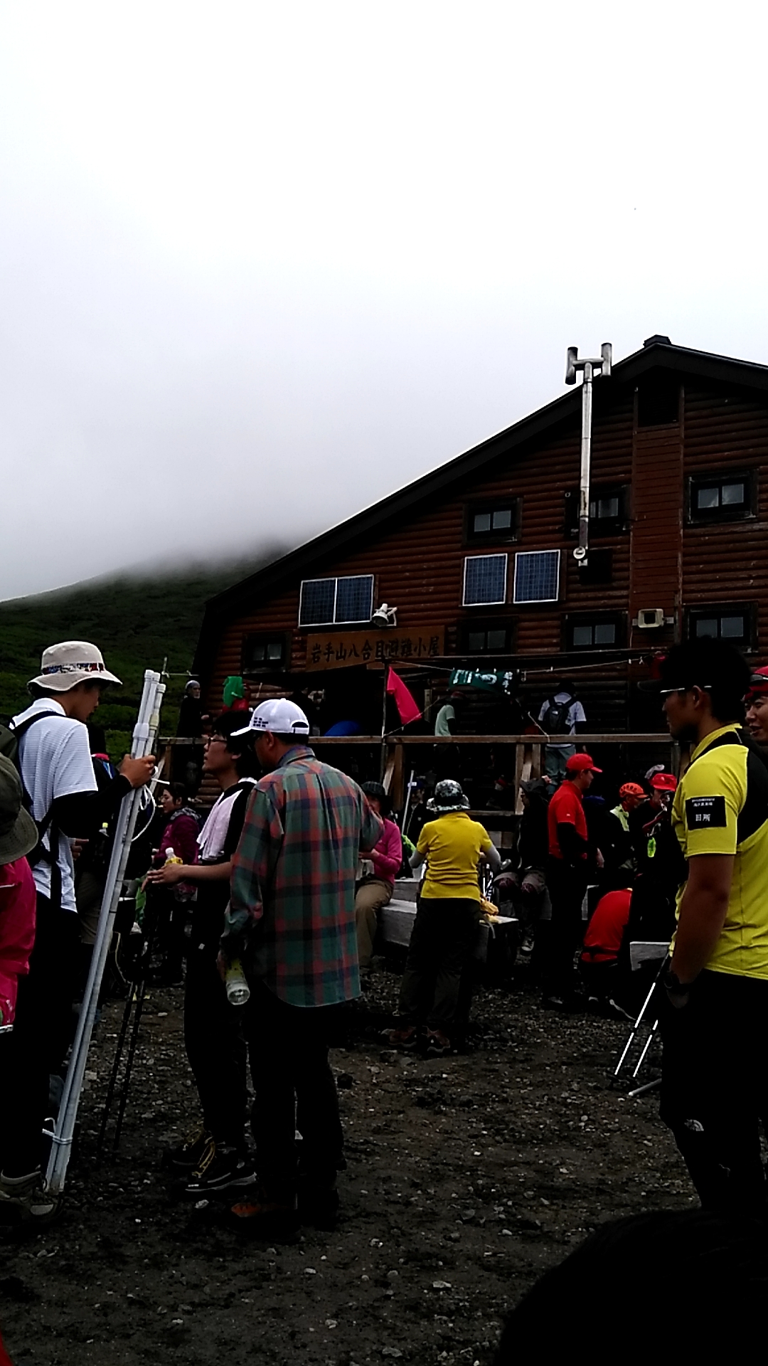
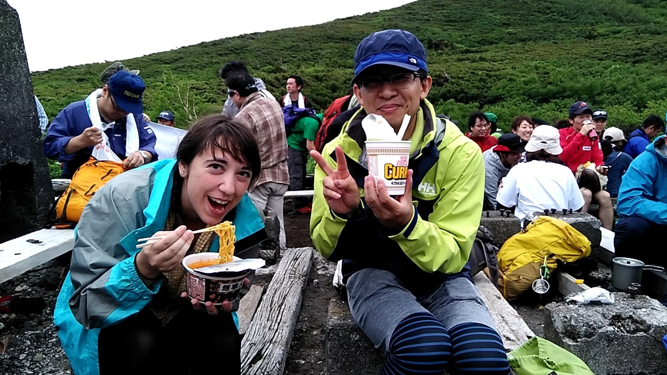
We reached this cottage where there were restrooms and fresh water. You could also stay overnight here (for a fee) if you choose.
Map: From the Towada-Hachimantai National Park homepage (Ministry of Environment)
URL: https://www.env.go.jp/park/towada/hachimantai/course/course_007/page_01/index.html
We took a brief break at the cottage for lunch. Some of us even brought out the ramen noodles! You might not believe it, but even Cup Ramen tastes like heaven when you’re up in the heavens.
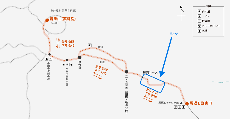
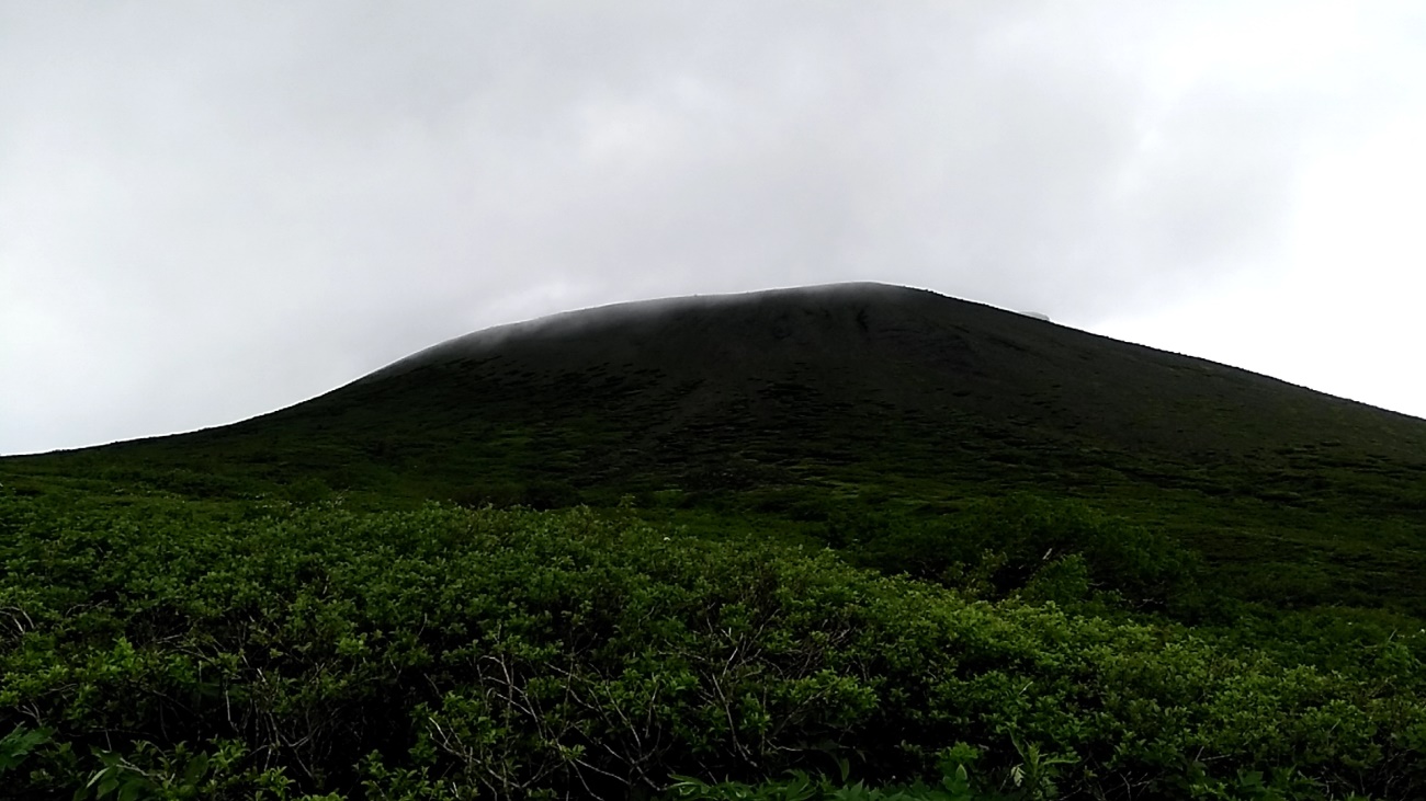
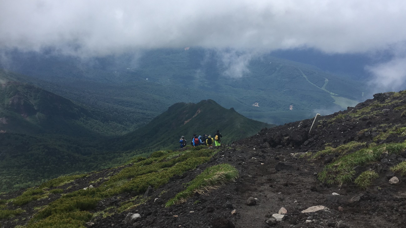
The top of Mount Iwate could be seen in the distance. Though we had been blessed with clear skies all morning, the top was covered in a misty fog.
The fog got thicker as we approached the summit.
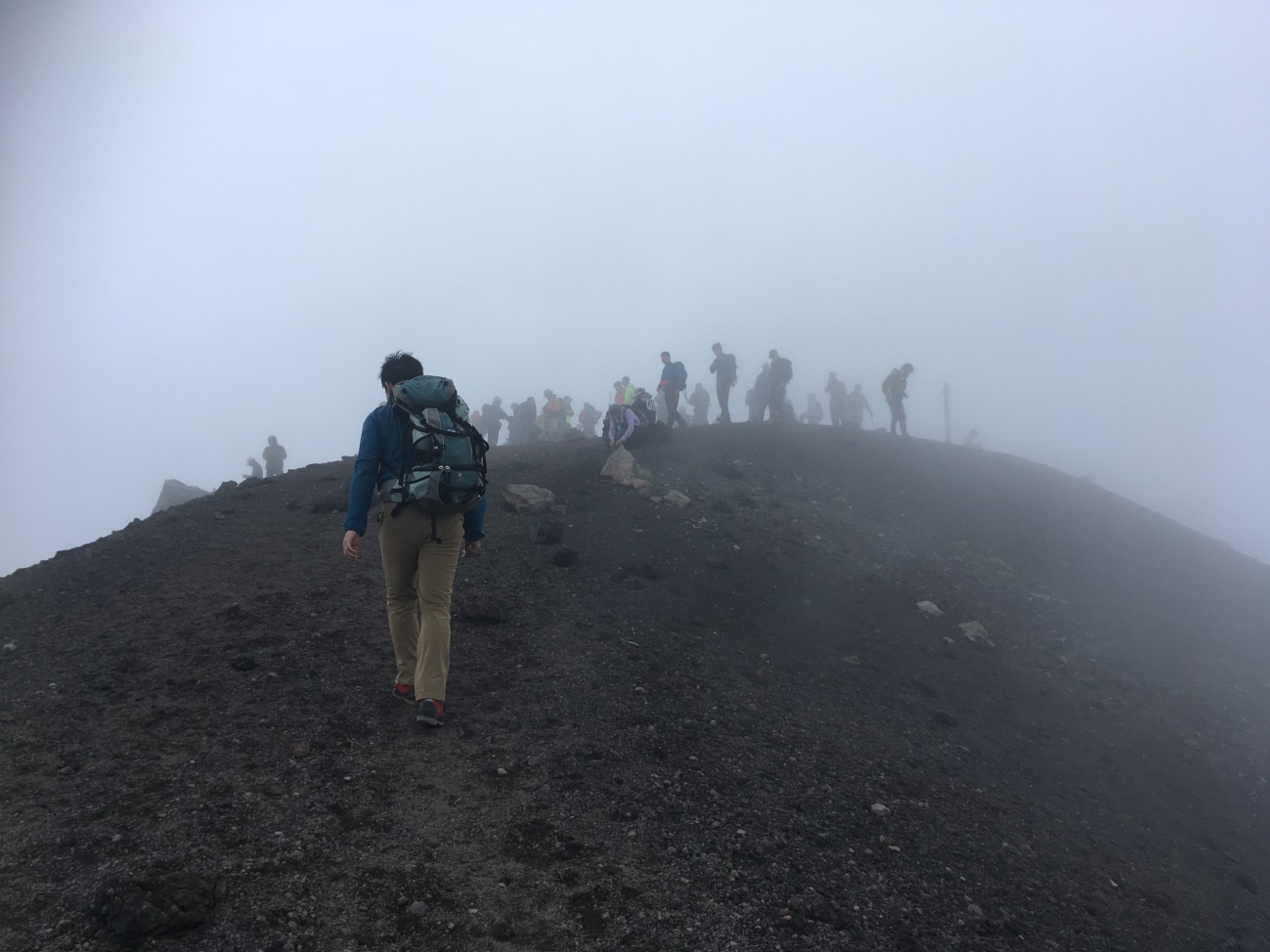
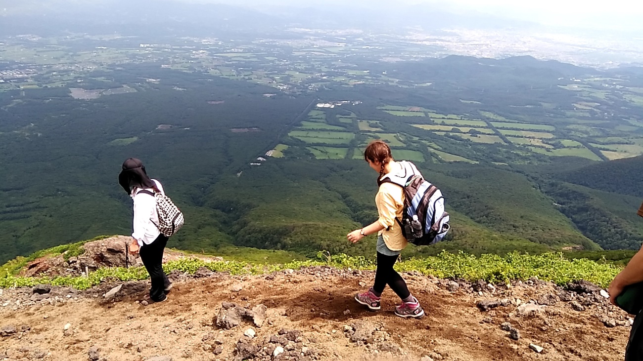
There were still times when the fog would clear up a bit, leaving us a window into the beautiful views below.
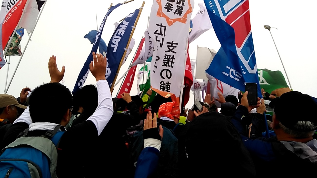
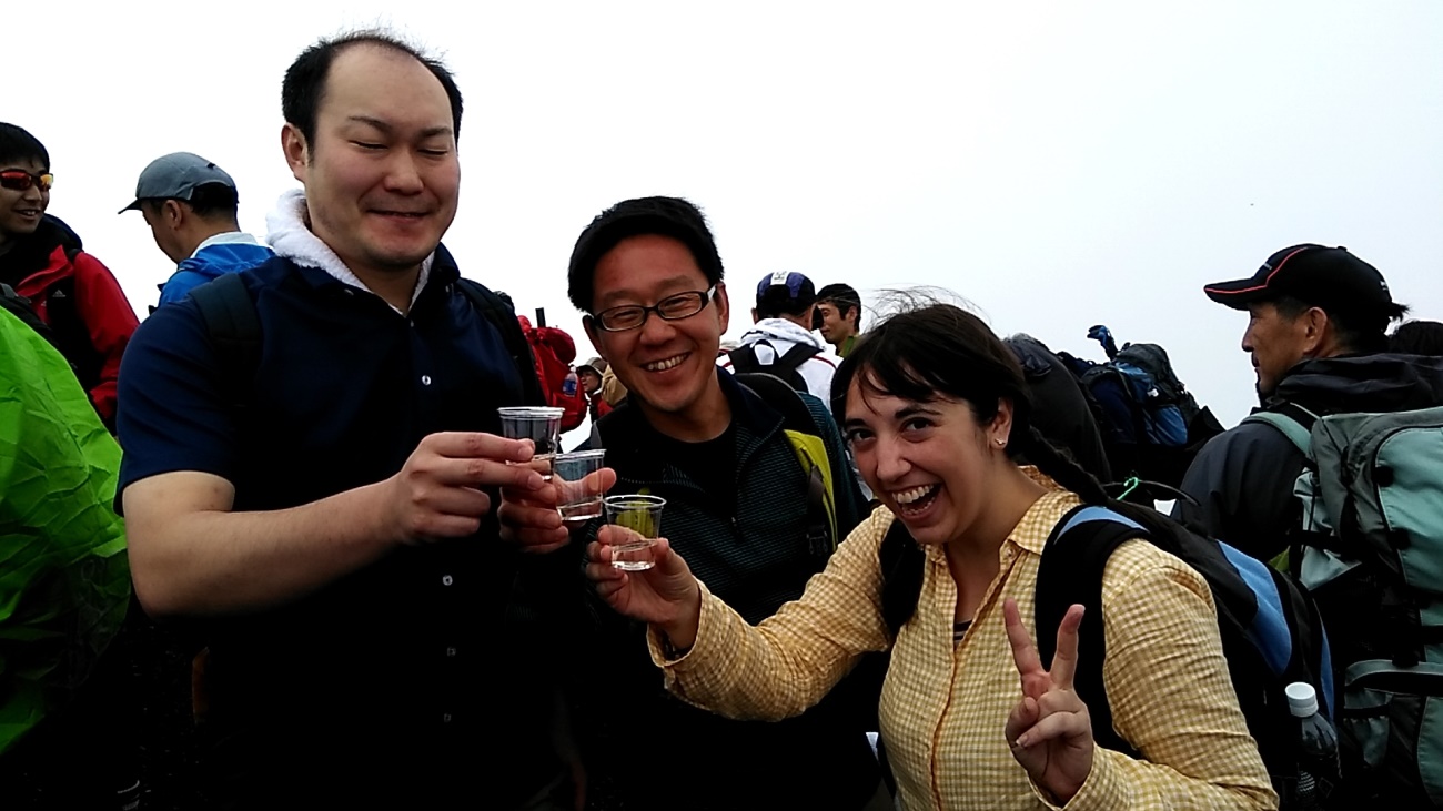
We reached the peak safely at around noon. There was a great shout of “Banzai!” from all the climbers, and then they brought out the Japanese sake.
Sake at the top!
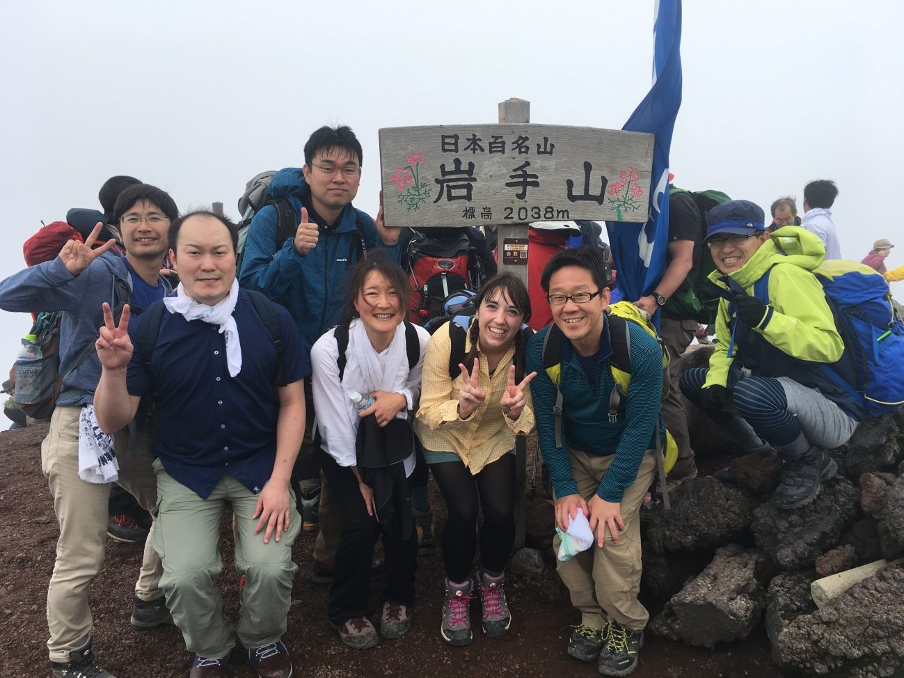
A commemorative photo of our team at the top of Mount Iwate
Map: From the Towada-Hachimantai National Park homepage (Ministry of Environment)
URL: https://www.env.go.jp/park/towada/hachimantai/course/course_007/page_01/index.html
We decided to take a different path on the climb down. Once we started to descend, the fog lifted almost immediately, so we could take in this awesome view of Morioka as we slowly made our way down.
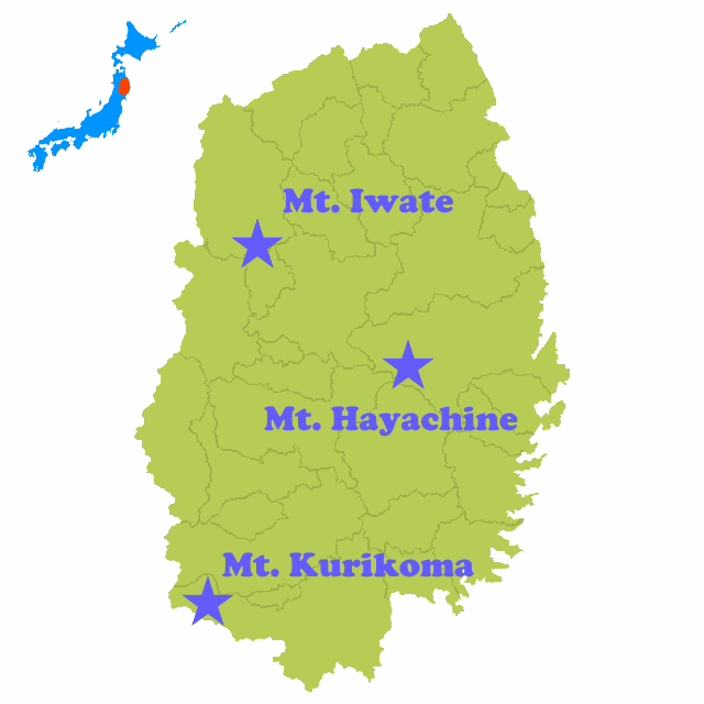
Iwate has tons of other wonderful mountains to climb, like Mount Hayachine (1,917m) and Mount Kurikoma (1,626m), making it a fabulous place for outdoor-lovers.
Next time you visit Iwate, we hope you consider taking a hike up one of our gorgeous mountains!
As a special treat, THE KITAKAMI TIMES writer Amanda Wayama put together a video of our time on the trail. We hope you take a look!
Japanese
岩手山に登ろう!!【カバー写真】
写真:十和田八幡平国立公園HPより(環境省)
URL:https://www.env.go.jp/park/towada/hachimantai/course/course_007/index.html
岩手山は岩手県を代表する山のひとつであり、古くから信仰の山として親しまれ、現在もたくさんの登山客で賑わいます。標高は、2,038メートルで、岩手では最高峰になります。見る角度によって様々な表情を見せ、特に「南部片富士」と呼ばれる、独特の山の姿が有名です。
岩手山にはそれぞれ個性的な登山道が7本あり、入山ルートと下山ルートを組み合わせることで何通りもの登山が楽しめることが特徴です。山頂からは北東北の広い範囲を一望でき、また無数の石仏や神社が設置されており、山岳信仰の伝統を今に伝えています。
【地図】
地図:十和田八幡平国立公園HPより(環境省)
URL:https://www.env.go.jp/park/towada/hachimantai/course/course_007/index.html
いつものILCリレーでは、岩手に住んでいるILCに関連する方々のご紹介をしていますが、今回は、研究者の皆さんへ岩手山を紹介するべく、山開きの日になる7月1日に岩手山を登った時の様子をご紹介したいと思います。
この日は、岩手山の代表的なコースであり、「馬返し登山口」という入口から登る「柳沢コース」というコースから登りました。登山当日は、「山開きの日」ということで岩手山登山を待ちわびた登山客でにぎわっていました。
【写真】
登山を待ちわびた登山客でにぎわう「馬返し登山口」入口(午前6:00頃)
【写真】
出発前には、安全を祈願して「神事(※)」も執り行われました。(※神を祭る行事)
【写真】
一緒に登山したチーム。最初の頃は元気でした(笑)
【写真】
登山道は木々に囲まれて、とても気持ちの良い景色でした。
【写真】
登山道から少し外に目を向けると、雄大な自然を眺めることができました。
【地図】
地図:十和田八幡平国立公園HPより(環境省)
URL: https://www.env.go.jp/park/towada/hachimantai/course/course_007/page_01/index.html
【写真】
後ろを振り返ると眼下には素晴らしい景色が広がっていました。
【地図】
地図:十和田八幡平国立公園HPより(環境省)
URL: https://www.env.go.jp/park/towada/hachimantai/course/course_007/page_01/index.html
【写真】
八合目の山小屋。ここでは、多くの登山客が山頂を目指す前に休憩をしていました。
この山小屋では、トイレや湧き水があるほか、宿泊(有料)もすることが可能です。
【地図】
地図:十和田八幡平国立公園HPより(環境省)
URL: https://www.env.go.jp/park/towada/hachimantai/course/course_007/page_01/index.html
【写真】
我々もこの山小屋で休憩をとりました。中にはカップラーメンを食べる人も。山で食べるカップラーメンは格別でした!!
【写真】
山頂を見上げると、これまでの快晴とは異なり、山頂付近には霧がかかっていました。
【写真】
山頂付近になると風も強く、霧も濃くなってきました。
【写真】
時には霧が晴れることがあり、その時は眼下に広がる展望を楽しむことができました。
【写真】
12時頃に無事に山頂に到着。登山者で万歳が行われ、この日は日本酒が登山者にふるまわれました。
【写真】
日本酒で乾杯
【写真】
チーム全員で記念撮影(山頂にて)
【地図】
地図:十和田八幡平国立公園HPより(環境省)
URL: https://www.env.go.jp/park/towada/hachimantai/course/course_007/page_01/index.html
【写真】
【写真】
下りは登ってきた道とは違う道を通って帰りました。山頂から少し下ると、霧もすっかり晴れて、素晴らしい景色を眺めながら下山することができました。
岩手県には、今回登った岩手山のほかにも、早池峰山(はやちねさん:標高1,917m)や栗駒山(くりこまやま:標高1,626m)など、他にも多くの素晴らしい山が存在し、アウトドアを楽しむことができます。
【地図】
ぜひ、岩手県に来た際には余暇の過ごし方として、「登山」という選択肢も入れてみてはいかがでしょうか?
最後に、今回の登山の様子を「THE KITAKAMI TIMES」の編集者でもある和山アマンダさんがまとめてくれた動画があるのでそちらをご覧いただければと思います。
【動画】